

The Nigerian Navy will unveil seven freshly created nautical charts that use the River Alape to connect the states of Ondo and Lagos.
The service launched 20 charts in March, increasing the total number of charts in the nation to 27.
A nautical chart is a map that shows things like water depths and potentially risky areas.
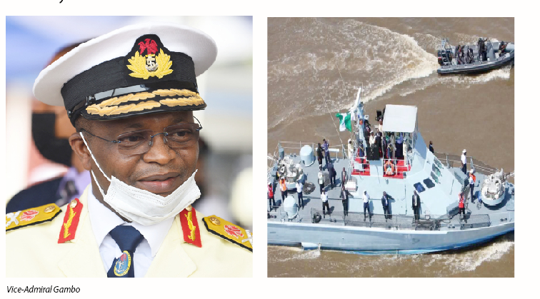
Vice Admiral Awwal Gambo, the Chief of the Naval Staff, stated during a news conference on Wednesday in Abuja that the charts will be displayed on June 21 at a celebration of World Hydrography Day.
According to him, “As part of the events for the plenary session of the 2023 World Hydrography Day, seven newly-produced navigational charts, linking Ondo to Lagos States through River Alape, produced by the Nigerian Navy, will be unveiled. The theme for the event is ‘Hydrography – Underpinning the Digital Twin of the Ocean’.”
Gambo, who the Chief of Policy and Plans. Rear Admiral Saidu Garba, represented. Said he was sad that marine debris, among other things. Was endangering Nigeria’s ability to use the ocean sustainably.
He stated, “Marine litters, indiscriminate marine resource exploitation, and inadequate ocean management tools are threatening sustainable use of the ocean in Nigeria. Therefore, developing the digital twin of Nigeria’s waters in particular, and the entire Gulf of Guinea, in general, will provide the needed interface between the policymakers, coastal communities, maritime security agencies, researchers, marine exploration and exploitation companies, as well as other maritime users that will foster the right action for sustainable ocean governance and uses in Nigeria.”
The Federation’s hydrographer, Rear Admiral Chukwuemeka Okafor. Said he was almost done with the new chart of the Calabar River. And that Imo State would have access to the sea after he finished the survey.
He said, “Suffice to say that we have, and are making good progress. In March this year, we unveiled about 20 charts covering River Niger from Lokoja to the Atlantic Ocean through River Amos and Focados River; that survey was done last year. Seven charts will be unveiled next week.”
cc: Punch Ng