

627
Since the days of the early days of human existence, humans have been in the habit of naming. This is a convenient way of distinguishing animate and inanimate things for the purpose of description and identification.
Inanimate things have been named by a man often on the basis of physical description, circumstances surrounding such or geographical features as in the case of most states in Nigeria.
About 60% of the states in Nigeria are named after geographical features with about 80% of these named after water bodies. Below are states in Nigeria named after a geographic feature:-
AKWA IBOM STATE.
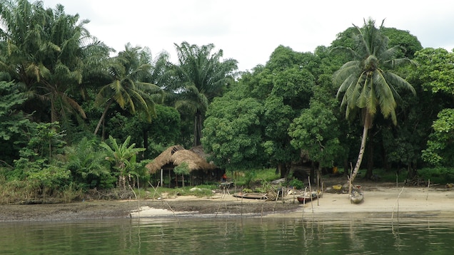
This Oil-rich South southern state is named after the Qua Iboe river. Geographically, the state is divided between the Central African mangroves in the coastal far south and the Cross–Niger transition forests in the rest of the state. Other important geographical features are the Imo and Cross rivers which flow along Akwa Ibom’s eastern and western borders, respectively while the Kwa Ibo River bisects the state before flowing into the Bight of Bonny.
ANAMBRA STATE.
This Southeast state with the second smallest land area in the country is known for inventions and creativity. The state is concurrently named after the Anambra river which runs through the state. Anambra is the Anglicized name of the Omambala. The state is popularly referred to as the “Light of the Nation”.
BENUE STATE.
Located in the North Central geopolitical zone; Benue is synonymous with agriculture and fishing and is rightly named after the Benue river. The Benue River previously known as the Chadda River or Tchadda is the major tributary of the Niger River. The river is approximately 1,400 kilometres (870 mi) long and is almost entirely navigable during the summer months. The size of its basin is 319,000 km2 (123,000 sq mi). As a result, it is an important transportation route in the regions through which it flows.
CROSS RIVER STATE.
This south southern state was named after the cross river (known locally as “Oyono”); a river that flows through the state. It was formed from the eastern part of the Eastern Region on 27 May 1967. Originally known as the South-Eastern State before being renamed in 1976, Cross River state formerly included the area that is now Akwa Ibom state, which became a distinct state in 1987.
DELTA STATE.
This south southern state is so named because the major rivers form deltas flowing through the state and emptying into the Atlantic ocean. It was formed from the former Bendel State on August 27, 1991. Asaba as its state capital is located along the River Niger on the northeastern end of the State, while the state’s economic centre is the twin cities of Warri and Uvwie.
EBONYI STATE.
Ebonyi was named after the Aboine river that flows in the state. It is also located in the Southeastern part of the country. It was formed from parts of Abia and Enugu state in 1996. Geographically, the state is divided between the Cross–Niger transition forests in the far south and the drier Guinean forest-savanna mosaic in the rest of the state
IMO STATE.
Imo was named after the Imo river in Southeastern Nigeria. Geographically, the State is divided between the Niger Delta swamp forests in the far east and the drier Cross–Niger transition forests in the rest of the State. Other key geographical features also include the state’s rivers and lakes with the Awbana, Imo, Orashi, and Otamiri rivers along with the Oguta Lake in western Imo State.
KADUNA STATE.
The Northwest state of Kaduna state is named after the River Kaduna. It is consequently a tributary of the River Niger. The name Kaduna is believed to be a corruption of the Hausa word kada, which means crocodile; the Kaduna River previously hosted a large crocodile population
KOGI STATE.
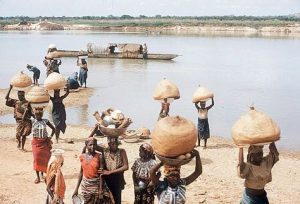
Kogi is a Hausa word for river. This confluence state is located in North Central Nigeria. It is also the only state in Nigeria to border ten other states. Kogi State was formed from parts of Benue State, Niger State, and Kwara State on 27 August 1991. The state is nicknamed the “Confluence State” due to the fact that the confluence of the River Niger and the River Benue occurs next to its capital, Lokoja.
KWARA STATE.
Kwara state is a state situated in North Central of Nigeria. It is named after the river Niger, as “Kwara” is the local name for River Niger. Geographically, Kwara state is split between the West Sudanian savanna in the west, and the Guinean forest–savanna mosaic ecoregion in the rest of the state. Important geographic features of the state include rivers, with the Niger flowing along the northern border into Lake Jeba, before continuing as the border, while the Awun, Asa, Aluko, and Oyun rivers flow through the interior.
LAGOS STATE.
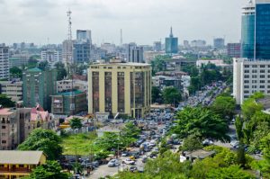
The South West state of Lagos is known as the economical hub of Nigeria. It derived its name from a Portuguese word for Lakes. Geographically, Lagos State is dominated by bodies of water with nearly a quarter of the state’s area being bodies of water. The largest of these bodies are the Lagos and Lekki lagoons in the state’s interior with the Ogun and Osun rivers flowing into them. Many other rivers and creeks flow throughout the state and serve as vital means of transportation for people and goods.
NIGER STATE.
Niger state is a state in the North Central geopolitical zone of Nigeria. It is one of the States in the country that is named after the River Niger. Two of Nigeria’s major hydroelectric power stations, the Kainji Dam and Shiroro Dam, are located in Niger State, along with the new Zungeru Dam. The Jebba Dam straddles the border of Niger state and Kwara state. The famous Gurara Falls is in Niger State, and Gurara Local Government Area is named after the Gurara River, on whose course the fall is situated.
OGUN STATE.
Ogun state is named after the Ogun river which flows through the state into the Lagos lagoon. Consequently, the State is covered predominantly by rainforest and has wooden savanna in the northwest.
OSUN STATE.
Osun state is named after the River Osun. It is located in South West Nigeria. Also, the river is a vital river which flows through the state. The state was formed from the southeast of Oyo State on 27 August 1991. Geographically, the state is divided between the Nigerian lowland forests in most of the state and the drier Guinean forest–savanna mosaic in the north. However, the major geographical features are rivers including the state’s namesake, the River Osun which bisects the state’s interior before forming much of the state’s southwestern border with Oyo State and flowing south. Other important rivers are the Erinle and Oba rivers, both Osun tributaries which flow from the north before meeting the Osun along the southwestern border.
RIVERS STATE.
This major oil-producing state is located in the Niger delta area of Nigeria. Many rivers are present in the state and that is what gave birth to the name “Rivers” state. Nonetheless, its geography is dominated by the numerous rivers that flow through it, including the Bonny River.
SOKOTO STATE.
The North West State of Sokoto is named after the River Sokoto. It is also home to the Rima River. Some people however purport that The name Sokoto is the modern/anglicised version of the local name, Sakkwato which is of Arabic origin. It represents suk, “market”. It is also known as Sakkwato, Birnin Shaihu da Bello or “Sokoto, Capital of Shaihu and Bello”.
TARABA STATE.
Taraba state is named after the Taraba river which flows through the southern part of the state. The river traverses the southern part of the state. The Benue, Donga, Taraba and Ibi are the main rivers in the state. Markedly, they rise from the Cameroonian mountains, straining almost the entire length of the state in the North and South directions to link up with the River Niger.
YOBE STATE.
Yobe derives its name from the Yobe river which flows through the state. It also borders four states: Bauchi, Borno, Gombe, and Jigawa. Yobe State shares borders with Borno State to the east, Gombe State to the south, Bauchi and Jigawa States to the west and Niger Republic to the north. It consequently borders to the north the Diffa and Zinder Regions of Niger.
ADAMAWA and PLATEAU STATE.
Both states are named after Plateaus found in them. Adamawa also takes its name from the historic emirate of Adamawa. Geographically, the state is mainly composed of the highlands of mountains (the Atlantika, Mandara, and Shebshi ranges). There is also the Adamawa Plateau, crossed by valleys and rivers, most notably the Benue and Gongola rivers. Identically, Plateau State is described as “The Home of Peace and Tourism”. With natural formations of rocks, hills and waterfalls, it derives its name from the Jos Plateau.
EKITI and ENUGU STATE.
Both states are named after hills. Ekiti is generally an undulating part of the country with a characteristic landscape that consists of old plains. Such rock out-crops exist mainly at Aramoko, Efon-Alaiye, Ikere-Ekiti, Igbara-odo- ekiti and Okemesi-Ekiti. The State is dotted with rugged hills, notable ones being Ikere-Ekiti Hills in the south, Efon-Alaiye Hills on the western boundary and Ado-Ekiti Hills in the centre. Similarly, Enugu is located at the foot of the Udi Plateau. Its key minor industry was mining. Especially coal in the Udi Hills around the city of Enugu.
If you’d like to see more about tourist attractions in Nigeria, click here. How much do you know about the geographical features of your state? Please, feel free to share some information with us in the comment section.